- Home
- About
- Services
Start unlocking endless possibilities
- Industries
- Case studies
- Blog
- Contact
In the realm of construction and excavation projects, avoiding damages to underground utilities is paramount to ensuring safety, mitigating costs, and maintaining project timelines. Augmented Reality (AR) technology emerges as a transformative solution, offering real-time visualization of underground infrastructure to aid in detecting obstacles before digging commences. This case study explores the challenges faced, the innovative solutions implemented, and the remarkable outcomes achieved by integrating AR in underground utility detection.
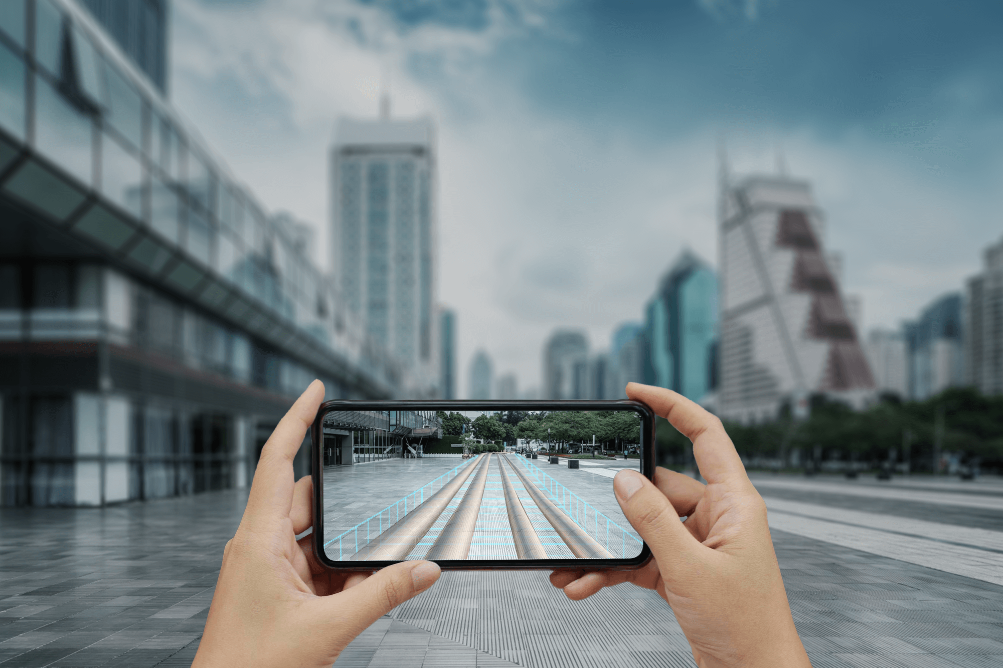
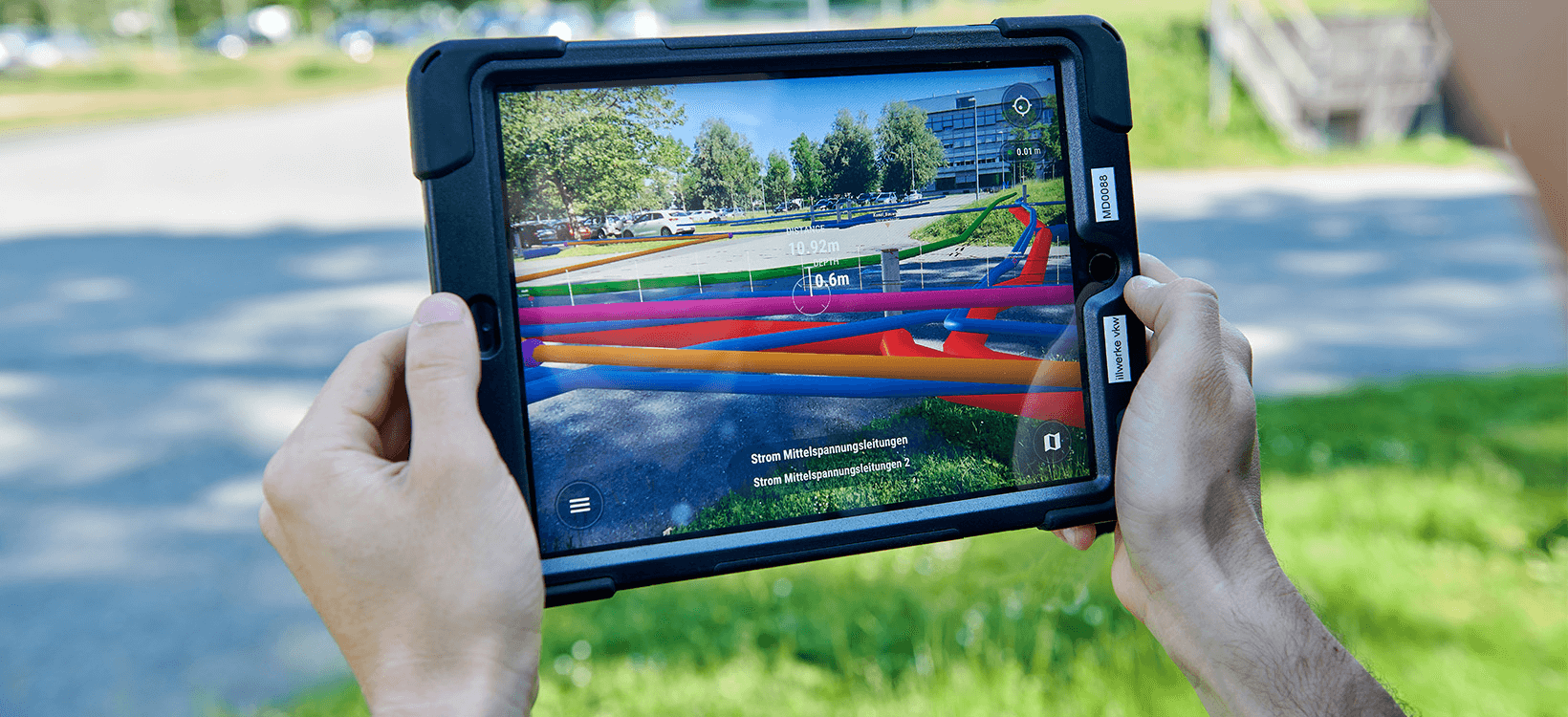
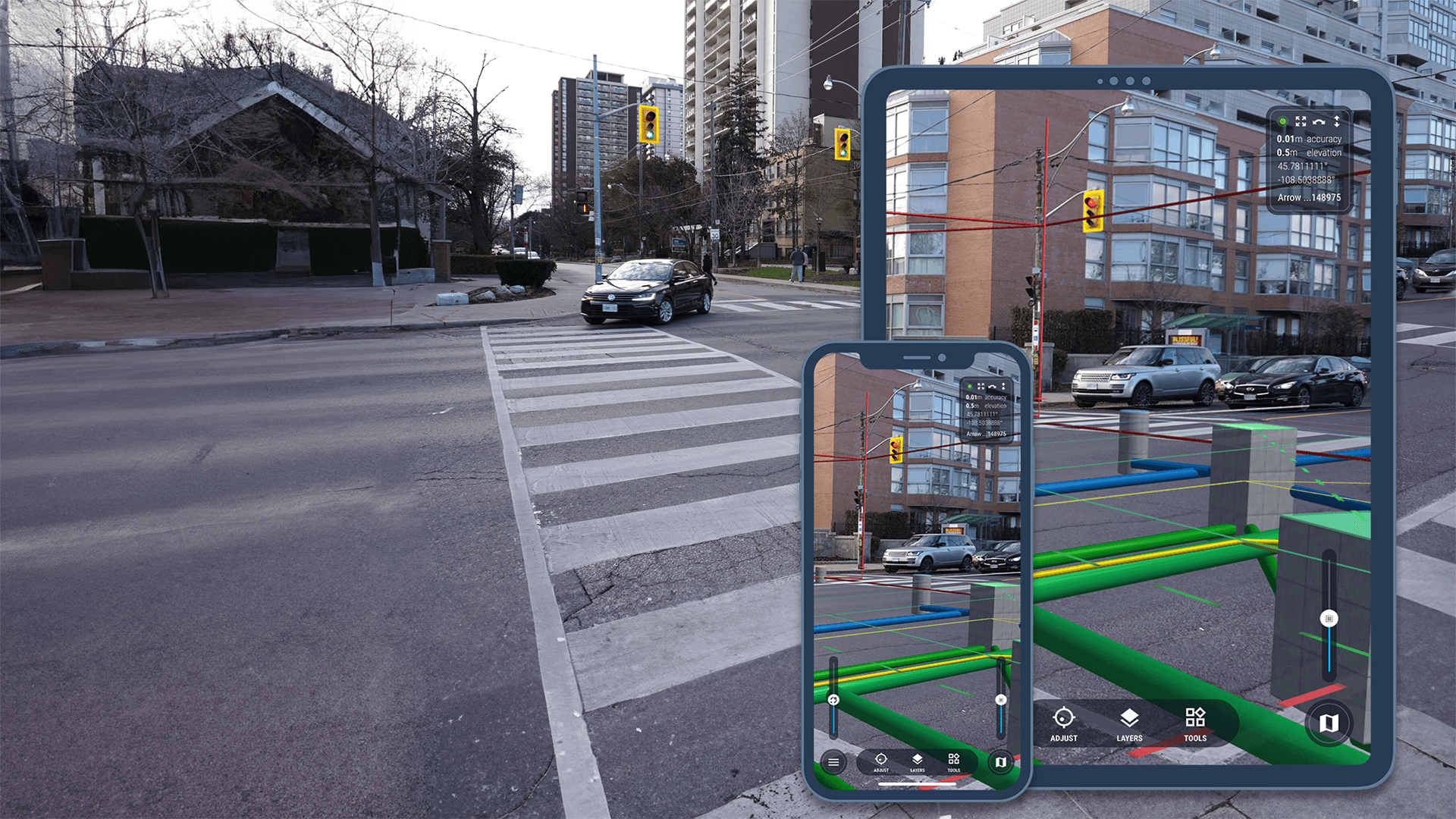
To address these challenges, our team proposed integrating AR technology into underground utility detection processes. Leveraging AR, users can visualize underground cables, pipes, and infrastructure in real-time through smartphones or tablets. By overlaying digital information in the real world, AR provides a comprehensive understanding of the underground utility network, allowing workers to identify potential obstacles before excavation begins.
Utilize LiDAR, GPR, and other sensors for accurate data collection on underground utilities. Ensure regular calibration and maintenance for optimal performance.
Thoroughly scan the project area using selected sensors. Process collected data in real-time to generate accurate 3D models of underground utilities.
Employ advanced software to model collected data in geospatially accurate 3D representations. Ensure models reflect the accurate location, depth, and layout of underground utilities.
Develop an AR application for tablets, offering construction teams real-time visualization of underground hazards. Integrate 3D models for seamless navigation and interaction.
Provide comprehensive training on AR application usage and data interpretation. Offer ongoing technical support to address any issues during project execution.
Consider environmental factors like weather and terrain during data collection. Implement measures to mitigate interference from surrounding structures.
Implement robust data security protocols to protect sensitive information. Encrypt data transmission and storage to prevent unauthorized access.
Conduct rigorous testing to ensure accuracy and reliability. Perform quality checks at various project stages to address discrepancies.
Integrating Augmented Reality technology in underground utility detection represents a groundbreaking advancement in the construction and excavation industry. By providing real-time visualization of underground infrastructure, AR prevents costly damages and delays and enhances worker safety and project efficiency. As AR and VR technology continues to evolve, utility mapping will undoubtedly undergo further enhancements, ushering in a new era of innovation and efficiency in the construction sector.
TILTLABS is a product realization company that operates mainly Metaverse, XR & Mobility, Virtual Production, Games & Gamification, Blockchain, and NFT. We specialize in using emerging technologies to create interactive, intuitive, and immersive experiences that really matter.
Ground Floor
Carnival Technopark,
Technopark Campus
Thiruvananthapuram- 695581
Kerala, India
[email protected]
+91 471 4050401
© TILTLABS. All rights reserved